
The Next Generation of Fire and Gas Mapping
With automatic optimizations using Genetic Algorithms
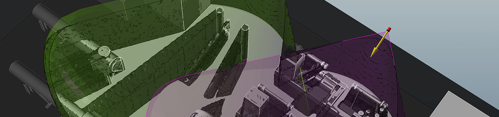
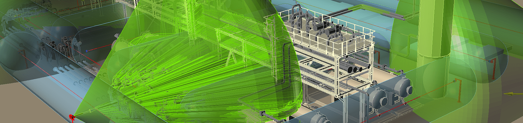
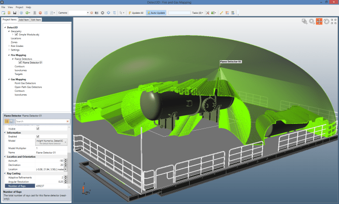
Minimize detector counts while maximizing coverage
Free Support and Updates
Developments created through industry partnerships
Get updates developed in days, not months
No CAD? No Problem
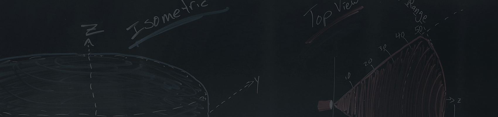
Use Detect3D's integrated geometry creation tool to manually create 3D models from scanned drawings or 2D DWG files.
The Best Fire and Gas Mapping Software. Period.
Efficient | Accurate | Validated
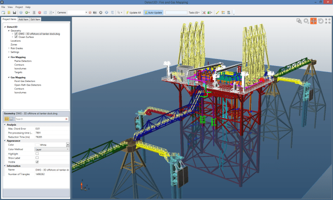
Works seamlessly with CAD
Imports DGN, DWG, DXF, STEP, IGES and more... Navisworks (NWD) files can be imported via DWF
Unmatched Calculations
Run analyses in seconds, not hours
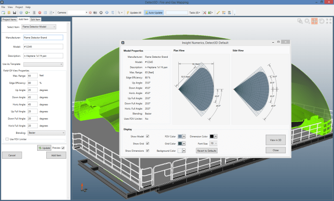
Manufacturer Data Built-In
Use detector data from our manufacturer partners, or create your own
Free Support and Tutorials
Multiple tutorials and example CAD files included
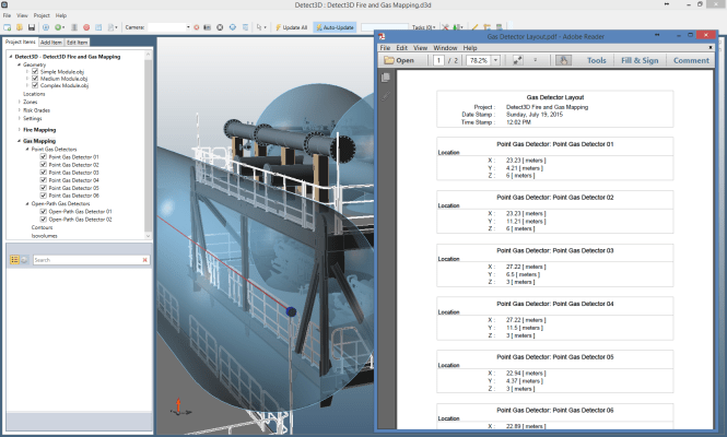
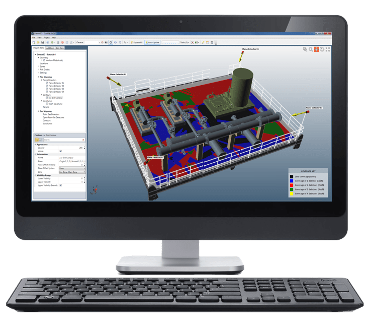
Auto-Generated Reports
Create Excel and PDF documents of detector locations and coverage values
Detect3D® Fire and Gas Mapping Software
Detect3D® gives your organization the ability to perform fire and gas mapping projects in-house. Developed by Insight Numerics, Detect3D® is designed using the most advanced algorithms focusing on reducing time and saving costs all while working directly with your CAD files.
- Seamless integration with CAD files (DGN, DWG, OBJ and more…), even Navisworks
- Reduce project duration by up to 70% of the time typically required by other solutions.
- Better manage costs through the project life cycle through our licensing structure, which allows for unlimited design changes.
- Share design updates between project teams at no additional costs using the free "Viewing Mode."
- Make use of Detect3D®'s optimization capability to determine the optimal positions of devices to reduce detector count while maximizing coverage.